
Continuuiti
Enterprise climate risk intelligence for assets, facilities, and supply chains, with API access for geocoding, hazard scoring, and damage estimates.
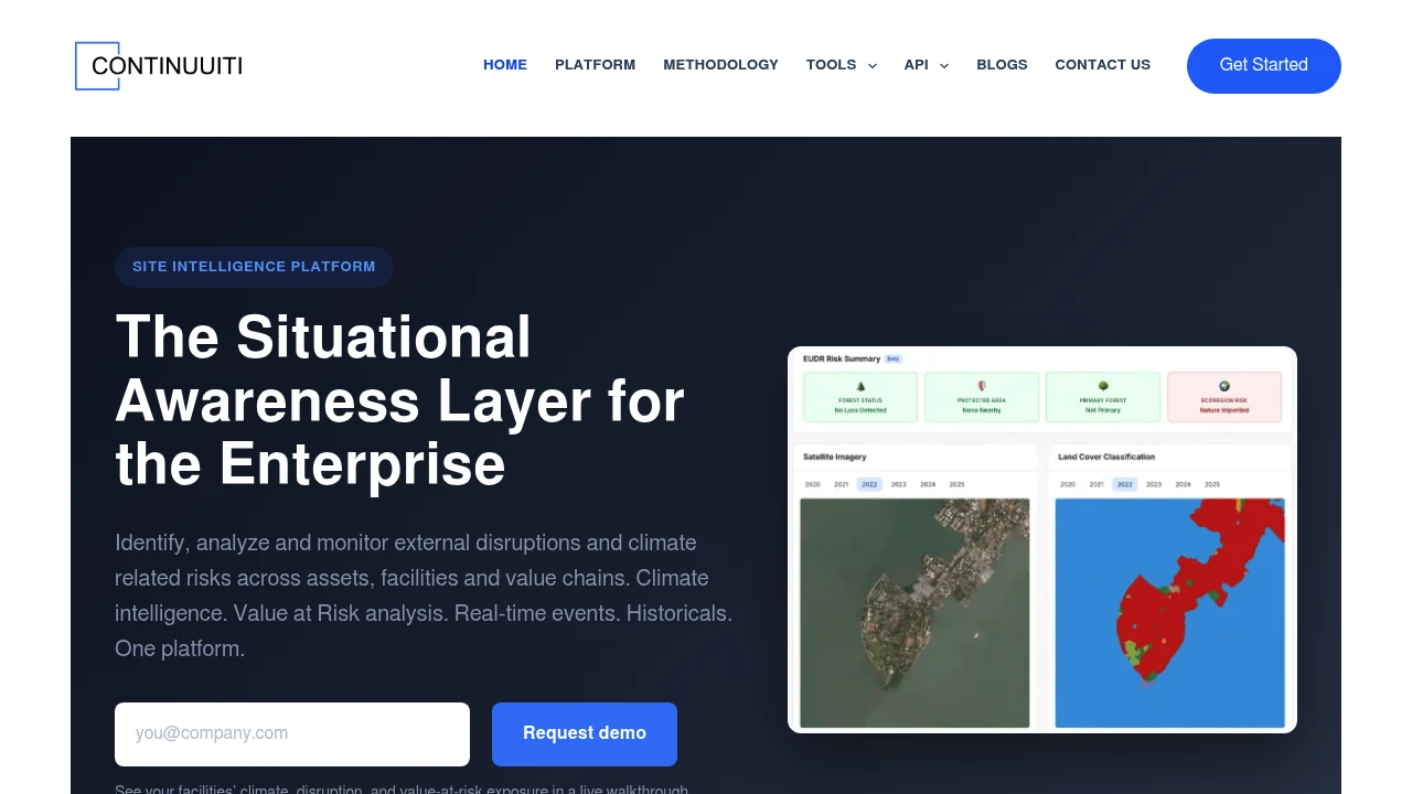
This climate and disruption risk intelligence platform helps enterprises assess climate exposure and disruption risk at the location level. It combines satellite imagery, climate projections, historical hazard data, and real-time event monitoring so teams can evaluate assets, facilities, and supply chains using site-specific evidence rather than broad regional summaries.
The platform covers both physical climate exposure and potential financial impact. Users can screen locations across 12 hazards, compare baseline and scenario-based risk through 2050, estimate building-level flood damage for value-at-risk analysis, and access structured data for TCFD-aligned disclosure and EUDR-related deforestation checks.
Key Features
Geocoding and Site Footprinting
Validate addresses, convert locations into coordinates, and examine the surrounding site context. Satellite time-lapse imagery and land cover data provide additional visibility into how locations and their surroundings have changed over time.
Land Cover Intelligence
Analyze land cover and changes across a five-year period using 10-meter resolution data. Locations can be classified across five land categories:
- Built-up areas
- Vegetation
- Water
- Cropland
- Bare soil
This provides useful site-level context for climate assessments, environmental screening, and deforestation-related checks.
Physical Climate Risk
Screen individual locations for exposure across 12 climate and environmental hazards. The platform supports comparison between baseline conditions and future scenarios through 2050, helping teams assess how physical risk may change over time.
Covered hazards include:
- Flood
- Wildfire
- Drought
- Extreme heat
- Cyclone
- Water stress
- Other supported physical hazards
Flood Intensity and Damage
Go beyond identifying whether a location is exposed to flooding. The platform provides flood-depth analysis across return periods from RP10 through RP500 and estimates potential building-level damage using depth-damage curves.
This makes the data useful for value-at-risk analysis where teams need to connect flood exposure with potential financial impact.
Real-Time Peril Monitoring
Monitor disruptive events that could affect facilities, assets, and supply chains. Event monitoring covers hazards and disruptions such as:
- Floods
- Outages
- Strikes
- Civil unrest
- Geopolitical disruptions
Historical context extending across 25 years helps teams compare current events against previous disruption patterns and understand the broader risk environment.
Compliance and Disclosure Data
The platform structures climate and environmental intelligence for regulatory and reporting workflows. Data can support TCFD-aligned disclosure and EUDR-related deforestation checks, helping teams incorporate location-level evidence into compliance processes.
API Access
Integrate climate and location intelligence directly into existing systems through REST API endpoints. Available capabilities include:
- Geocoding
- Land cover checks
- Climate risk scoring
- Flood damage estimates
- Batch processing
- JSON output
The API supports large batches of locations per request and provides sandbox testing, making it suitable for teams that need to process portfolios or supply-chain locations programmatically.
Built For Enterprise Risk & Operations Teams
Financial Services
Screen portfolios, properties, and other assets for physical climate exposure and potential financial impact. Building-level flood damage estimates can also support value-at-risk analysis.
Real Estate
Assess individual properties and sites using hazard exposure, flood intensity, land cover, and scenario-based climate projections.
Operations Teams
Monitor facilities and supply chains for climate hazards and real-time disruptions. Historical event data provides additional context when evaluating operational resilience.
Compliance & Risk Teams
Use structured location-level evidence for climate reporting, TCFD-aligned disclosure, EUDR-related checks, and broader environmental risk assessment.
Common Use Cases
Portfolio Screening
Evaluate large numbers of locations for physical climate exposure and identify assets that may require deeper assessment.
Underwriting
Incorporate location-level climate risk, hazard exposure, and potential damage estimates into underwriting workflows.
Due Diligence
Assess properties, facilities, and other locations using satellite evidence, historical hazards, land cover intelligence, and future climate scenarios.
Supply Chain Risk
Screen supply-chain locations and monitor disruptive events that could affect facilities, suppliers, or operational continuity.
Resilience Planning
Compare current and future risk scenarios through 2050 to identify locations where climate exposure may require mitigation or adaptation planning.
API-Powered Climate Intelligence
The platform is designed for both analysts working through a web interface and teams building climate intelligence into their own systems. Bulk API processing allows large sets of locations to be assessed without manually reviewing each site, while JSON output makes results easier to incorporate into existing workflows.
This makes the platform particularly useful for underwriting systems, portfolio screening tools, due diligence workflows, and resilience planning applications that need repeatable, location-level climate intelligence.
Why It Matters
Regional climate assessments can miss the differences between individual buildings, facilities, and supply-chain locations. Location-level analysis provides more specific evidence about the hazards surrounding a particular site, how those risks may change under future scenarios, and what the potential financial impact could be.
By combining satellite imagery, land cover data, climate projections, historical hazards, flood damage modeling, and real-time disruption monitoring, the platform gives enterprise teams a unified way to assess both physical exposure and operational consequences.
Assess Climate Risk at the Location Level
Bring climate, hazard, environmental, and disruption intelligence into a single workflow. Screen locations, model future exposure, estimate potential damage, monitor disruptive events, and integrate the resulting data into enterprise risk, underwriting, compliance, and resilience workflows.


